TAFFAN DESIGN & BUILD CONTRACTING
Taffan Design & Build Contracting is a company with a outstanding and established reputation for servicing Electro Mechanical EPC construction works across Saudi Arabia, U.A.E, Oman & India.
ENGINEERING SERVICES
3D LASER SCANNING
LASER SCANNING is a relatively new technology, having been used as a precise survey instrument only. Now, it is quickly becoming the new industry standard as a way to make very accurate measurements in complicated environments. This is precisely why using this technology is the best solution for measuring as-built conditions inside buildings. This instrument collects survey data points at a rate of 50,000 points per second. It has an effective range of 400’ to 500’. With several “scan” setups inside a room or of a building, a complete 3D model can be made of the existing conditions. These models are then used to create 2D civil or architectural drawings, 3D computer models, and final survey documents.
1.1 TERRESTRIAL LASER SCANNING
Terrestrial scanning uses a ground-based or tripod-mounted light radar (commonly referred to as LIDAR) to create high resolution 3D images of surfaces and objects. LiDAR measures a scanned object by emitting laser pulses and recording the subsequent intensity of their return when reflected off it. Scanning can be performed over kilometres with sub-centimetre precision. Terrestrial scanning is commonly used for heritage documentation, 3D topographical surveys, accident sites, confined spaces survey and Mechanical, Electrical and Plumbing (MEP) models.
TCS Survey Engineering the earliest adopters of Terrestrial Laser Scanning technology in Dubai. Over the years, we have worked together with our clients throughout Dubai to provide outstanding solutions to engineering problems. Our experienced engineers and CAD designers are experts in their field and work in close collaboration with our clients to ensure a timely and successful outcome to every project.

1.2 OIL & GAS 3D MODELING
The 3D-modeling technology of oil-and-gas fields allows building modern oil-and-gas development projects using information systems and technologies of the world’s leading software producers, and authoring optimizing the modeling process.
BIM SERVICES
We are having the tool and technologies to implement the BIM process for our projects which we do and having the experienced BIM/ Auto Desk CAD modellers for delivering all kind of BIM deliverables as follows.
- BIM execution Plan
- 3D model
- BIM co-ordination
- Clash Detection
- Shop Drawing
- As-Built Drawing
- Complete Architectural, Structural & MEP Services drafting will be carried in REVIT-2021 software.
- Complete Infrastructure Utility services drafting and design using Bentley & Civil 3D Softwares.
TOPOGRAPHICAL SURVEY
The purpose of a Topographic Survey is to gather survey data about the natural and man-made features of the land, as well as its elevations. From this information a three-dimensional map may be prepared. You may prepare the topographic map in the office after collecting the field data by GPS or Total Station.
3.1 GPS CONTROL SURVEY IN DUBAI
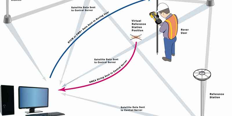
GPS CONTROL SURVEY provide “basic control” or horizontal and vertical positions of points to which supplementary surveys are adjusted. These types of survey (sometimes termed geodetic survey) are conducted to provide geographic positions and plane coordinates of triangulation and traverse stations and the elevations of benchmarks. These control points are further used as references for hydrographic surveys of the coastal waters; for topographic control; and for the control of many state, city and private surveys.
Users should ensure that their post-processing applications have adequate quality assurance to correctly exploit this industry standard data. The defining of selected locations by establishing a system of reference points.Geodetic Surveying is a process of surveying in which the shape and size of the earth are considered.The obtaining of reconnaissance information and preliminary data required by engineers for selecting suitable routes and sites and for preparing structural design.
3.2 LAND SURVEY
TCS Survey Engineering an experienced team of surveyors providing highly detailed surveys using the very latest equipment.
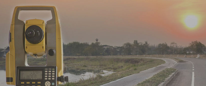
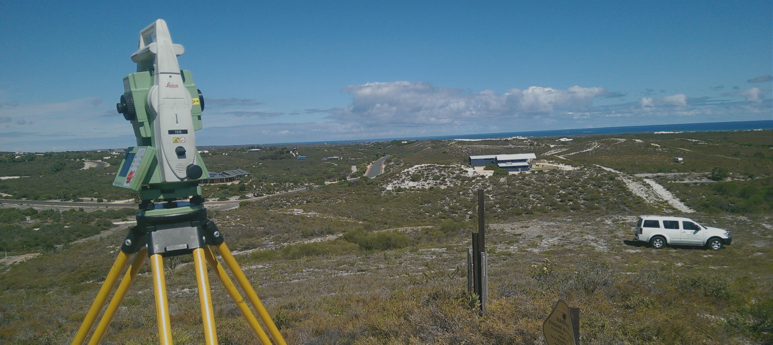
We carry out our Topographical surveys using the latest Leica Robotic Total Stations and (Real-time GPS) to deliver to our clients a cost effective, highly accurate detailed survey.Our highly experienced Surveyors have worked on thousands of land surveys over the years from simple Land boundary surveys to highly detailed surveys; from private gardens to City Centres we cover all.
Our survey specifications are tailored to each clients needs, whether for local Planning Authorities, Architectural or Design Offices.
We provide a range of services including:
- Land and Topographical Surveys
- Measured Building Surveys
- Building Elevations
- Service Tracing

3.3 ROAD SURVEY
We are a well-renowned name in this domain, engaged in offering Road And Highway Survey Services at the most reasonable price.
TCS Survey Engineering can be used to provide an accurate layout of the road, utilities, drainage, overhead wires, nearby buildings, and other features. With multiple teams trained to Street works, Lighting & Guarding utilising the latest Total Stations, Survey equipment we are able to perform a survey of a carriageway or public highway with the minimum disruption to the flow of traffic, whilst still delivering highly accurate data.
TCS Survey Engineering also produce As-Built Surveys for Highway and Sewer Adoption to the standard detailed in the latest revision of Sewers for Adoption. This includes providing drawings to the required standard and colouring schedule for the adopting authority.
3.4 CONTOUR SURVEY
We are a well-renowned name in this domain, engaged in offering Contour Survey Service at the most reasonable price.
We also have with us rich industry experience in successfully matching up with the demands of flawlessly carrying out Contour Surveys for our customers. As undisputed leaders in our services, we ensure these are at par with international quality standards. Some of the areas these find application in include Civil engineering firms where contour as well as alignment surveys are required. Further, we also ensure that CAD designs as well as conventional drawings aid in many economic, feasible as well as dependable factors of tasks executed in efficient manner. Here, we also ensure that these surveys are offered at affordable pricing.
We ensure that there is flawless execution of contour and alignment surveys for civil engineering firms. For this, we present drawings as well as other representations for land development works where it helps in evaluating different economical, feasible as well as dependable factors of concerned works.
DRONE SURVEY
Drone Survey in Gulf is a highly specialized type of surveying. It requires an extensive knowledge of the requirements of the Federal Aviation Administration (FAA) Advisory Circulars in order to successfully complete the work to the accuracies required for acceptance by National Geodetic Survey (NGS) and the FAA. This survey work forms the basis for the FAA Airports GIS initiative and is critical for the development of safe and accurate approach procedures.
4.1 AERIAL SURVEY

GPR SURVEY
In the congested landscape of today’s increasingly complex utility infrastructure, the technician can be overwhelmed with the multitude of interwoven metallic and non-metallic utilities. Wouldn’t it be easier to see what’s underground without the cost and disruption of exploratory excavation? A truly portable and cost-effective Ground Penetrating Radar (GPR) system that gives cable and pipe surveyors worldwide the ability to see what’s underground.
5.1 UNDERGROUND SERVICE DETECTION SURVEY
TRAFFIC SURVEY
TCS Survey Engineering, The Company targets to deliver consulting services in the field of Survey Engineering, Traffic Data Collection, Environmental Studies, Traffic Impact Studies as well as quality field data collection with utmost accuracy. Our expert team is also capable of conducting large scale Transport Surveys required for developing city-wide transport demand models and manual Trip Generation. In addition, we offer full range of traffic engineering services.
We are highly capability of providing full assistance with intelligent transportation, parking management, security, communications, integrated systems in traffic management. To deliver our clients with clear, accurate and easy to read data summaries on time. To impart high quality traffic engineering services to effectively meet all the needs of our clients.To keep at par with technological advances, local engineering standards and best engineering practices.

HYDROGRAPHIC SURVEY
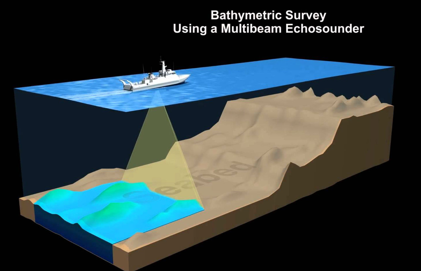
HYDROGRAPHIC SURVEY are made to acquire data required to chart and/or map shorelines and bottom depths of streams, rivers, lakes, reservoirs and other larger bodies of water. This type of survey is also of general importance to navigation and to development of water resources for flood control, irrigation, electrical power, and water supply. As in other special surveys, several different types of electronic and radio-acoustical instruments are used in hydrographic surveys.These special devices are commonly used in determining water depths and location of objects on the bottom by a method called taking SOUNDING. Sounding are taken by measuring the time required for sound to travel downward and be reflected back to a receiver aboard a vessel
Most surveys are primarily concerned with water depth.The nature of the sea floor material because of the implications for anchoring, dredging, structure construction, pipeline and cable routing and fisheries habitat.SONAR (Sound Navigation and Ranging) uses sound waves to find and identify objects in the water and to determine water depth.The data is collected and processed digitally with specialized computer systems that store the data in digital form.
